Registry Search
The search page contains query tools for finding and viewing the details of coordinate systems, transformations, and other definitions.
There area two main ways to perform a search, either by using the map search in the center of the screen, or a text search in the left sidebar. Both search methods appear on the same page in the desktop version, but are two separate pages in the mobile version.
Map Search
Use the map search to find definitions based on location. The website will ask for your location to assist with this, if you choose to accept.
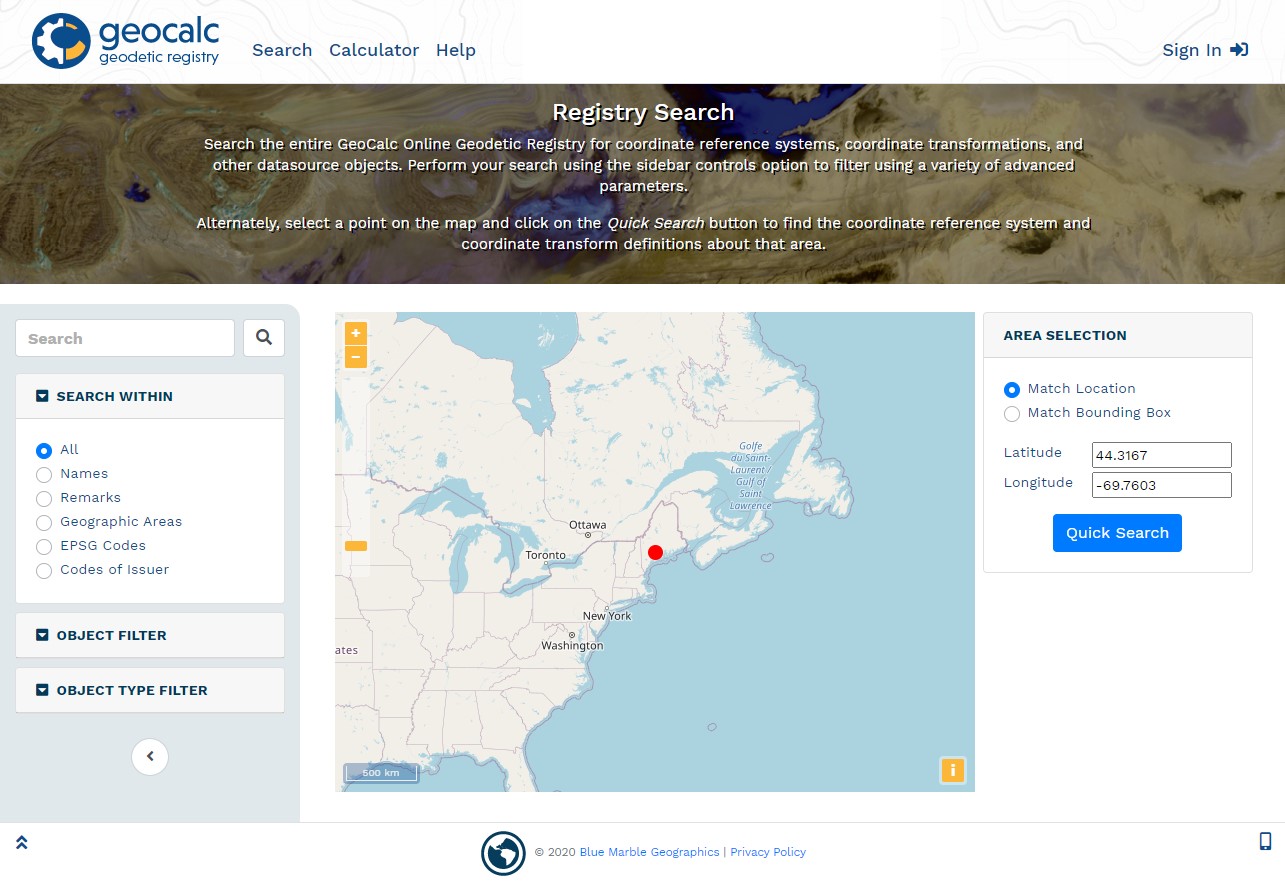
Match Location
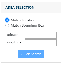
Specify a location by Latitude, Longitude coordinates, or click on the map to place a point. The website may ask for your location for use with the Match Location option.
Enter Coordinates manually in Decimal Degrees or click on the map to populate the values. This will return all object that have an area of use containing the point.
Select on Map
Mouse over the map to display coordinates of the cursor location in the top right corner. Click on the map to update the coordinates in the Latitude and Longitude values.
To zoom in and out, scroll the mouse wheel or use the plus and minus buttons in the top left.
To pan the map click and drag the mouse wheel, or click and drag the left mouse button.
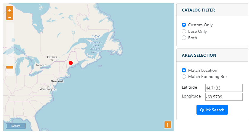
Match Bounding Box
Choose this option to specify a bounding box to filter the results by location. Enter coordinates for the South, West, North and East extent in Decimal Degrees, or choose the Select on Map button to specify the bounding box.
The bounding box specified must be contained entirely inside the area of interest to return the result.
Select on Map
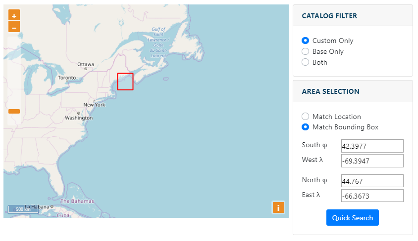
Choose this option to draw a bounding box on the map. See above for more information on navigating the map. Click with the mouse to begin a bounding box, then click again to complete it. The coordinates of the bounding rectangle will be displayed at the bottom.
The current cursor location will be displayed in the top right of the map window.
Filtered Search
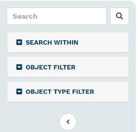
In the left side bar is a text base search that provides additional search filter options. Type your query in the search field.
Below the search bar are a number of filters that can be applied to constrain the search results.
Search Within
Use the Search Within radio buttons to search only within specific fields.
| All | Search within all fields. This includes object names, remarks, identifiers, and area of use names and remarks. |
|---|---|
| Names | Search within the descriptive name of the object |
|
Remarks |
Search within the comments saved with the object. This may include supplementary information. |
| Geographic Areas | Search the name and descriptions of the area of use of the object. |
| EPSG Codes |
Search by the EPSG code |
| Codes of Issuer | Search by other issuer codes. Choose the issuer from the drop down list. |
Object Filter
| Include Early Bound CRS | Early bound coordinate systems are those that contain a transformation as part of the coordinate system definition. These systems can only be transformed using the transformation specified in the CRS definition. |
|---|---|
| Include Deprecated | When enabled the search results will include objects that have been deprecated. EPSG objects that are deprecated are older definitions that have been replaced by another definition that is seen to supersede the deprecated object. Deprecated records should only be used when documenting or reversing use of the record that was made before it was declared invalid. |
|
Display Verbose Results |
This will display additional information about objects in the search results, including Datum, Unit, Min and Max Point, Area of Use, Dimensions, etc. For Early Bound Coordinate Systems verbose results will also display the Base Coordinate System and Transform Name. When Verbose results are off, the search will only display the Name, EPSG code when applicable, and Remarks. |
Object Type Filter
Filter the search by object type to find results for only specific objects.
Search Results
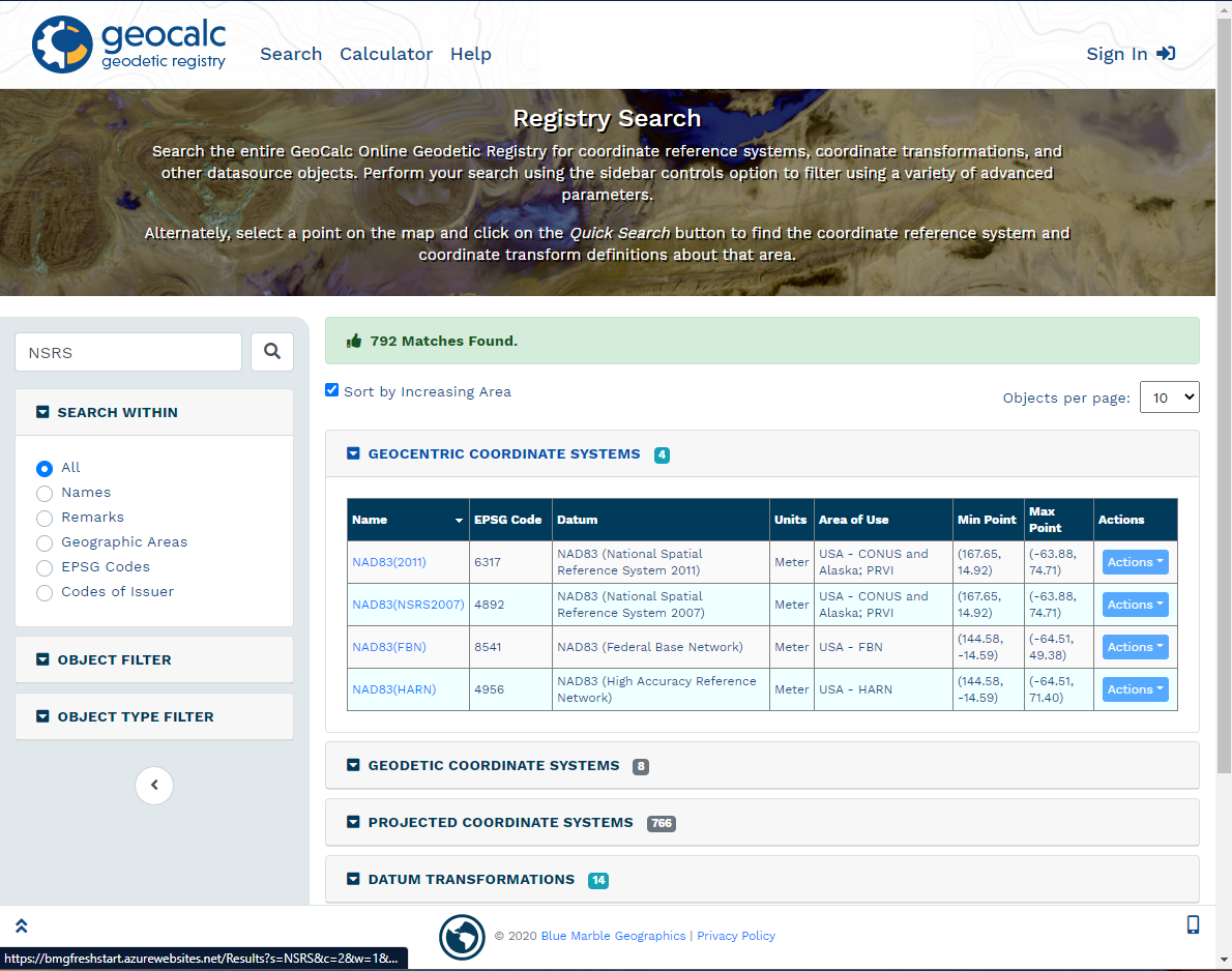
The results of the search query will display in the right pane. The total number of matching objects is listed in the green bar at the top. The results are separated by object type. Press the arrow next to the object type to show or hide the results.
The Sort by Increasing Area option is enabled by default. When checked, objects with the smallest area of use will appear first in the results. When unchecked, the results will be sorted alphabetically by Name. It is also possible to click on some of the columns in the results, to sort by that column.
Specify an Objects per page value to determine how many results to show for each object type. Objects that contain more matches than the page limit will show page numbers at the bottom of the results. Click the page number at the bottom of the results table to move between pages.
Click the object name to view the full object definition.
For more information on the object values or full definitions see Definitions
Actions
Note, this section requires a log in with a Blue Marble Geographics account.
Choose the Actions menu to perform an action with the object. The View GML Definition and View WKT Definition options will open a new tab with the GML or WKT definition.
Set as Converter Source and Set as Converter Target options can be used to populate the convert page with the system found in the search result, in either the source or the target.